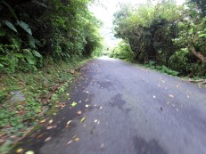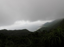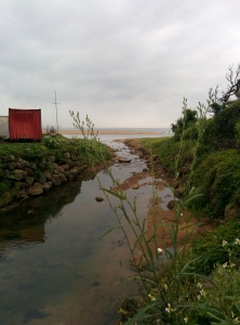
 This is a nice average length trail (12 km) which takes place mostly on paved trails. Running along the coast, it offers a nice climb with ocean views ending on the beach, perfect for a hot summer day.
The course begins at Dali (大里) train station in Yilan (宜蘭), an hour and a half, by train from Taipei. This ancient trail was originally constructed by the government to span the Northern coast of Taiwan. With the initial leading all the way from Danshuei (淡水) on the Northwest coast to the east coast province of Yilan (宜蘭), this section is the only one that remains today. The trail has been paved since 1807 with sandstone slabs making it easier for farmers and traders to walk from village to village.
 Starting at the Dali train station, make sure to bring food and water, as there aren’t any places to stop along the way. The trail from the station is fairly obvious, turning right out of the station. Following a large trail, that leads to a temple, continue up with stairs at the back right hand side of the temple. Nearing the 2km mark the trail starts to incline and forks into either stairs or road. Opting for road will give you a good hill workout, while avoiding the slippery steps.
It doesn’t take long to reach the ridge which is certainly the steepest and most interesting part of the trail. From the top of the ridge it is not uncommon to see swathes of clouds and thick humidity coming off the pacific ocean, but clear or foggy, it provides an interesting view. At the top of the ridge is the division between the Caoling historical trail and the Taoyuan valley trail (桃源谷步道).
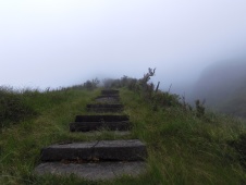
 The Taoyuan valley trail is a rather recent extension to the original trail. This trail is a grassy bluff extending along the coast line where the grass is kept trim by water buffalo which roam freely within the Taoyuan valley. Although we initially were going to do the Caoling trail exclusively but the Taoyuan trail with its misty staircase was to difficult to resist. On clear days the Taoyuan trail offers some of the best views possible of the northeast coast.
After making a detour a little way up the Taoyuan trail, we headed back in the direction we came, to finish the Caoling trail. The footing on the Taoyuan trail tends to be a little treacherous because of the sandstone steps and constant humidity. On the other side of the ridge, as the trail begins to wind down to Fulong beach the surrounding scenery changes to forest.
 We passed a monument on our way down from the ridge reading “阿莫雄鎮蠻煙”. Translating to “Boldly Quell the Violent Mists” This monument was carved into the rock to serve as a beacon for travelers using the Caoling Trail. To prevent those who would encounter heavy fog from having difficulty finding their way. There were rumors of the mountain processing magic causing the smelly ocean fog to hang around the trail, deterring business from that area. This fog is said to have caused fear and hesitation for those who crossed through. The inscription in the monument was added by Liu Ming-deng, the head of the Qing army stationed in Taiwan, and is said to help suppress the evil magic of the mountain.
 Heading further down the trail, the scenery changed again to rural, flat road. Traveling from South to North allows a swim at the end of the run. The trail is also difficult to locate from the Fulong side. There is also the option to start at DaXi station (大溪), to include the entire portion of the Taoyuan valley trail (on sunnier days this would be ideal).
You can find the Garmin map here and the directions from Taipei Main here.
